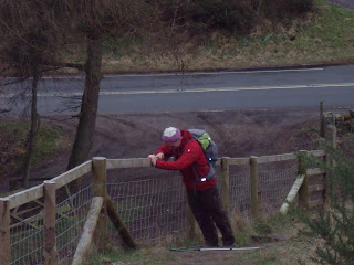
At 3.30am on Friday we left the car park at the bottom of the White Horse to start our trek the first 12 miles are an absolute doddle as we passed Sutton Bank, Gomire Lake, Boltby Forest before descending towards Osmotherly. At 11 miles we made our first pit stop, sitting back with a snack and a hot drink next to Oak Dale reservoir I felt like I would of been content to sit there for the rest of the day but with another 29 miles still to go we had no option but to pack up and roll out. A further mile down hill took us through Osmotherly and from there we made our way to Carlton Bank trig point 1339ft and finally to Lordstones Cafe for our 2nd pit stop and lunch with 21 miles completed. The cafe is closed for winter and renovations but we made use of a nicely situated bench at the back of the cafe out of the wind, unfortunately my food flask hadn't managed to keep my food hot I suppose seven hours was asking a bit much but some luke warm beef stew was far more appealing than freezing cold pasta. Next on the agenda were the ascents of Cringle
Moor 1417ft, Cold Moor 1329ft, Hasty Bank 1306ft and then the long trek all the way to the highest point on the North York Moors which is Round Hill 1490ft. I'm convinced it's harder walking up them than running up them as it takes twice as long to ascend each of them, next time I run up them I'm sure I will say it's a hell of a lot harder running up them. My mate Jon cramped up at the very start of the ascent of Round Hill much to my amusement as I heard his walking poles clatter to the floor, luckily
after a brief spell he managed to get going and that was his last and only cramping session so he
is definitely getting stronger with each trek. The next check points were Bloworth Crossing and the slight incline up to Tidy Brown Hill and by my quick guesstimations before the walk this is where
we should of clocked up around 30 miles and be ready for our 3rd and final pitstop. It was raining at the time and windy so we opted to
continue down to Kildale village, each mile got longer and longer and we were chuffed to bits to finally arrive at Kildale with 34 miles under our belts. We didn't find a bus stop or a village hall to get out of the rain but we did find an excellent little cafe which was perfect for an unscheduled sit down and an hot drink. I have no doubt that I will be revisiting the cafe either on another trek or a drive in the countryside. Warmed up and refuelled off we headed up to
Captain Cook's monument and after a brief photo stop and a good look at our final destination we hastily hobbled with red hot aching feet towards Roseberry Topping. It's less than a couple of miles from captain Cook's Monument to the base Roseberry Topping but it felt like a million miles the final ascent was extremely pleasurable in a strange sort of way and at 38 miles we had completed our challenge. I say completed but as I explained at the start there is still the final mile descent to the car park that requires completing and at 13 hrs 36 minutes that is exactly what we achieved, 39.14 miles according to the Garmin GPS watch.
Once again much needed Margret was there to pick us up, it might of looked like we were two

 soldiers coming off the hilltop in the dark and even more so as it sounded like we departed the car park in a battle tank as Marg's car exhaust had blown a hole in it.


No comments:
Post a Comment